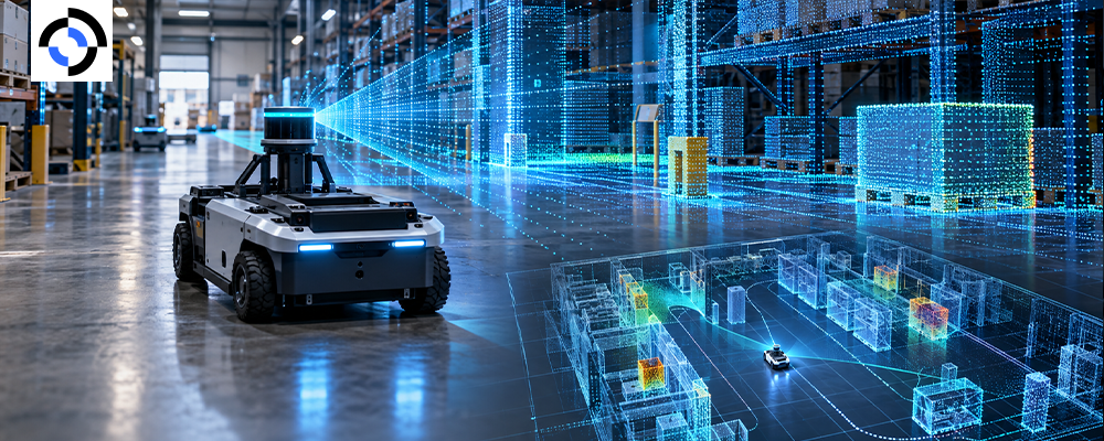
A mobile robot cannot navigate a warehouse, factory, hospital, or outdoor environment from camera images alone. It needs to understand distance, geometry, obstacles, surfaces, and spatial relationships—and LiDAR is one of the most useful sensors for building that understanding.
That makes LiDAR data collection robotics programs fundamentally different from ordinary image capture. The output is not a folder of photographs. It is a time-sequenced 3D representation of the robot’s environment, often combined with IMU, RGB-D, camera, and other mobile robot sensor data.
The challenge is turning those raw measurements into training-ready 3D perception data.
This guide explains what a useful LiDAR dataset contains, where point cloud annotation fits, what can go wrong during collection, and how Roborax builds sensor-data programs for teams training autonomous robots.
Why LiDAR data matters for mobile robots
LiDAR measures distance by emitting laser pulses and measuring their return. Repeated across thousands or millions of points, those measurements create a three-dimensional representation of the surrounding environment.
For a mobile robot, that representation can support:
- Obstacle detection
- Autonomous navigation
- Simultaneous localization and mapping (SLAM)
- Free-space detection
- Object detection
- 3D scene understanding
- Path planning
- Dynamic-object tracking
- Localization and mapping
The commercial demand for these capabilities is expanding. The International Federation of Robotics reported that almost 200,000 professional service robots were sold in 2024, with transportation and logistics accounting for 102,900 units—more than half of professional service robot sales in its sample. IFR specifically identifies this category as including mobile robots used for transportation and handling of goods.
That growth puts pressure on perception systems to work outside controlled laboratory environments.
As IFR President Takayuki Ito put it, “There is strong demand for service robots in a number of different application areas.”
The implication for robotics teams is straightforward: more deployed robots means more environments, edge cases, and sensor conditions that perception models need to understand.
What a LiDAR point cloud actually contains
A LiDAR scan is more than a collection of dots.
Each point can contain spatial coordinates such as X, Y, and Z, while some sensors also provide intensity, reflectivity, timestamp, ring/channel information, or other metadata.
A single sequence can therefore capture:
| Data element | What it provides |
|---|---|
| XYZ coordinates | 3D position |
| Intensity | Strength of returned signal |
| Timestamp | Temporal alignment |
| Sensor pose | Robot position/orientation |
| Frame ID | Sequence organization |
| Reflectivity | Surface-related information |
| Semantic labels | Meaning assigned to points |
This makes point clouds particularly valuable for models that need geometric understanding rather than appearance alone.
A camera can tell a robot that something looks like a pallet. LiDAR can help determine where that pallet is in three-dimensional space and how much room exists around it.
The point cloud annotation problem
Raw LiDAR is useful to an engineer. It is not automatically useful as supervised training data.
That is where point cloud annotation becomes important.
Depending on the model and application, annotators may label:
- 3D bounding boxes
- Individual objects
- Semantic regions
- Ground and non-ground points
- Vehicles
- Pedestrians
- Pallets and containers
- Shelving
- Obstacles
- Navigable space
- Dynamic versus static objects
The annotation strategy should follow the intended model.
For example, an obstacle-avoidance model may need precise free-space and obstacle labels. An object-detection model may require 3D bounding boxes. A semantic-segmentation system may require point-level classification across the entire scene.
The mistake is treating all point cloud annotation as the same job.
The collection trap: clean data that teaches the wrong thing
The easiest LiDAR dataset to collect is often the least representative.
A robot moving through an empty warehouse at midday produces clean scans. But a production warehouse contains workers, forklifts, pallets, temporary obstructions, reflective surfaces, changing lighting, and constantly changing traffic patterns.
The same problem appears outdoors.
Rain, dust, fog, vegetation, uneven terrain, parked vehicles, pedestrians, and construction zones can create conditions that never appear in a controlled test environment.
A useful dataset therefore needs environmental diversity, not simply a high frame count.
At Roborax, we treat the collection environment as part of the dataset specification—not as an afterthought.
What a strong mobile robot sensor dataset captures
A serious mobile robot sensor data program should define its capture matrix before collection begins.
Environment
Capture across the places where the robot is expected to operate:
- Warehouses
- Manufacturing facilities
- Retail environments
- Campuses
- Hospitals
- Roads and sidewalks
- Loading areas
- Mixed indoor/outdoor environments
Dynamic conditions
The dataset should include objects that move independently of the robot:
- People
- Forklifts
- Carts
- Vehicles
- Other robots
- Doors and gates
- Temporary obstacles
Sensor conditions
The collection plan should also deliberately introduce sensor-relevant variation:
- Different speeds
- Different robot trajectories
- Varying point density
- Occlusions
- Reflective materials
- Dark surfaces
- Tight spaces
- Open spaces
- Static and dynamic scenes
The objective is not to make every frame difficult. It is to prevent the training distribution from becoming artificially clean.
LiDAR alone is rarely the whole perception stack
Modern robotics increasingly relies on multimodal sensing.
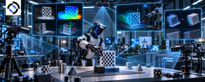
Roborax supports synchronized capture involving LiDAR, RGB-D, IMU, tactile, force/torque, audio, thermal, and event-camera streams, depending on the requirements of the robotics program. Its multimodal capture workflow is designed to align different sensor streams into a common timeline.
For autonomous navigation, a typical combination might include:
LiDAR + RGB-D + IMU
LiDAR contributes 3D geometry. RGB-D provides visual and depth information. IMU measurements provide motion information.
The combination can produce richer 3D perception data than any individual sensor can provide.
But sensor fusion introduces another requirement: synchronization.
If the camera sees an object at one position while the LiDAR measurement corresponds to a slightly earlier robot pose, the resulting training sample can contain spatial inconsistencies.
That is why calibration, timestamp alignment, extrinsic parameters, and frame-level quality checks belong in the data pipeline.
From sensor capture to training-ready data
A production-grade workflow generally looks like this:
1. Define the perception objective
Start with the model requirement—not the sensor. Determine whether the dataset is intended for detection, segmentation, SLAM, navigation, tracking, or sensor fusion.
2. Design the capture matrix
Specify environments, object categories, routes, speeds, environmental conditions, and edge cases.
3. Calibrate the sensor stack
Establish accurate intrinsic and extrinsic parameters and verify the robot-to-sensor coordinate relationship.
4. Capture synchronized data
Record LiDAR together with required camera, IMU, or other sensor streams.
5. Run data QA
Identify dropped frames, corrupted scans, timestamp errors, sensor drift, excessive noise, and incomplete sequences.
6. Annotate the point clouds
Apply the project’s ontology for 3D boxes, semantic segmentation, object classes, free space, or other required labels.
7. Validate annotations
Use automated checks, reviewer workflows, consensus mechanisms, and project-specific quality thresholds.
8. Package for model development
Deliver structured datasets in the format required by the robotics team’s training or evaluation pipeline.
The final objective is not simply “more LiDAR.”
It is more usable information per training sample.
What Roborax brings to LiDAR data collection
Roborax approaches robotics data collection as an ML operations problem rather than a simple labeling exercise.
Our teams can support the workflow from sensor capture through annotation and QA, including multimodal programs where LiDAR must remain synchronized with other sensor streams.
Our current multimodal capture infrastructure supports LiDAR point clouds aligned with camera frames, IMU sequences, and other modalities, with outputs available in formats including ROSbag, MCAP, HDF5, or customer-defined schemas.
That matters because a robotics team should not have to rebuild its perception-data pipeline every time the sensor stack changes.
Roborax’s broader robotics data operation currently reports 2.4M+ trajectories, 41 delivery centers, 12 countries, and 99.4% label accuracy, with programs covering teleoperation, human demonstration, multimodal sensor capture, annotation, and evaluation.
The goal is simple: deliver data that can move directly into the robotics team’s development loop.
The International Federation of Robotics (IFR) provides global statistics and research covering industrial and service robotics, including mobile and autonomous mobile robot applications. Its World Robotics 2025 Service Robots report recorded almost 200,000 professional service robots sold in 2024, with transportation and logistics representing the largest application category in its sample.
As mobile robots move from controlled demonstrations into real operating environments, the quality of their perception data becomes increasingly important.
Roborax helps robotics teams collect, structure, annotate, and validate that data at scale.
If you are developing an AMR, autonomous navigation system, mobile manipulator, or multimodal perception model, tell Roborax what your robot needs to learn, which sensors you use, and where it operates. Our team can scope the capture and annotation pipeline around your requirements.
Start a robotics data project with Roborax and turn raw sensor streams into training-ready perception data.
Frequently asked questions
Is LiDAR better than cameras for mobile robots?
Neither sensor universally replaces the other. LiDAR provides strong geometric and distance information, while cameras provide rich visual information. Many perception systems use both.
What is point cloud annotation used for?
It converts raw 3D sensor measurements into structured labels that machine-learning systems can learn from. Depending on the task, this can include 3D bounding boxes, semantic segmentation, object classes, or navigable-space labels.
How much LiDAR data does a robotics project need?
There is no universal number. Dataset requirements depend on the robot, environment, task, sensor configuration, model architecture, and diversity of expected operating conditions. Coverage is generally more informative than raw point or frame counts.
Should LiDAR be collected with other sensors?
For many advanced perception systems, yes. Synchronized LiDAR, camera, depth, and IMU data can provide complementary information. The required combination should be determined by the model’s input architecture and deployment environment.
Can Roborax collect and annotate LiDAR data?
Yes. Roborax supports multimodal sensor capture, LiDAR point-cloud workflows, robotics annotation, and QA programs designed around customer-specific perception requirements.
Related Reading
- What Is Egocentric Data Collection? A Plain-English Guide for Robotics Teams
- Force-Torque Sensor Data in Teleop: Why Contact-Rich Tasks Need It
- Teleoperation Latency Budgets: How Many Milliseconds Actually Ruin a Demonstration
- Remote Operations for Delivery Robots: What Happens When One Gets Stuck
- Autonomy Handover Design: Giving a Human Control of a Moving Robot
External reference